Actually, this one could be a more interesting one if it were combined with other neighbourhood-level discussions because of the methods being used to get people to focus on where they live rather than ‘big strategies’.
TL/DR/ I just want a pothole repaired! See https://www.cambridgeshire.gov.uk/residents/travel-roads-and-parking/roads-and-pathways/roadworks-and-faults
Active Travel Hierarchy
What does that mean to the general public? Mainly walking and cycling if you live in urban areas, and with the addition of horse-riding in rural areas where there are stables and/or residents that keep horses.
You can see the page here, and the County Councils’ FB announcement here.
Above – the announcement on the thing formerly known as birdsite
You can respond to their general survey here, and/or you can zoom into your neighbourhood below:
“Use our Map. To help you provide feedback, we have produced a hierarchy map(External link) of the County, which is available here(External link). We invite you to provide location-specific comments on how you think the highways and Public Rights of Way in your area should be prioritised within the three hierarchies. You can also add written feedback to give us added detail. This will give us a valuable understanding of which routes are important to communities and stakeholders, and why.”
The hierarchy map is hosted on the county council’s website at https://www.cambridgeshire.gov.uk/residents/travel-roads-and-parking/active-travel-in-cambridgeshire/active-travel-hierarchy-map and the map bit to play with looks something like the below image.
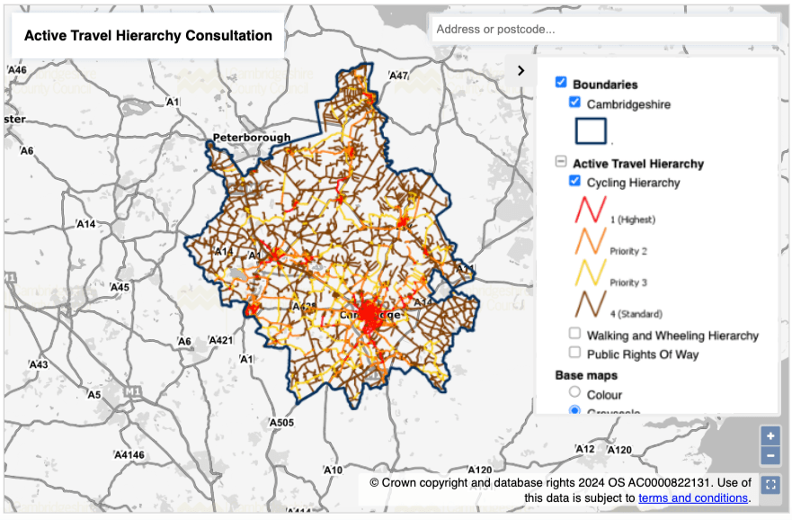
Above – you can see why you have to zoom in using the icons at the bottom-right

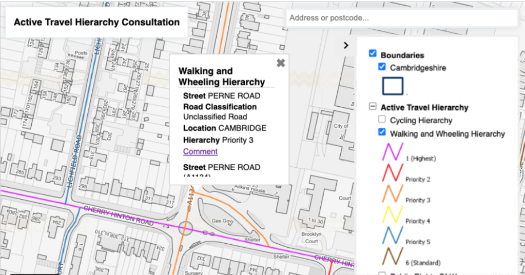
Focusing on the walking rights of way, you can see that as you head into urban areas, more of the roads have been allocated as having a greater priority for pedestrians, electric buggies and other low speed mobility machines. Zoom further into South Cambridge and we see the difference between rural and urban.

To make a comment on a particular road, click on the road you’re interested in. In my example here I’ve selected ‘Adkins Corner’ named after Mr Adkins who used to run the shop that later became Budgens and is now a Co-op. It is currently ‘Priority 3’ but I think it should be ‘Priority 1’ because of the number of pedestrians and cyclists that use the road and footpath. Actually, that whole area needs re-engineering.
If you deselect the walking and select Cycling, you get to comment on the cycling hierarchy, Whichever one you select, if you click on the ‘Comment’ link you get a pop-up box that asks you to fill in stuff for the road you’ve selected.
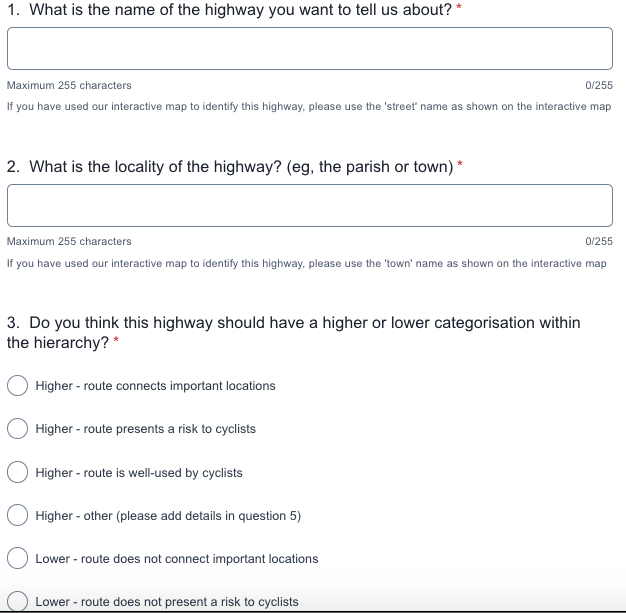
And it looks something like the above.
Have your say. In my case I threw in a little bit of local history – this is my childhood neighbourhood after all and I have been one of generations of children and teenagers since the 1960s that have used that route during my school days.
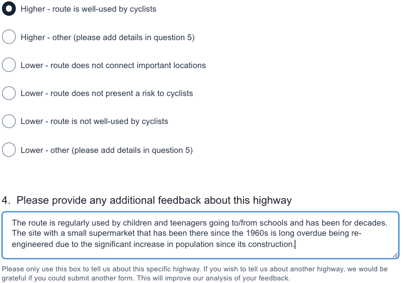
Hence asking the county council to re-engineer the route (which I assume will also deal with the potholes) to make it safer for pedestrians, cyclists, and also motorists stopping up at The Co-op.
The consultation closes for feedback on Monday 16 September 2024.
If you are interested in the longer term future of Cambridge, and on what happens at the local democracy meetings where decisions are made, feel free to:
- Follow me on Twitter
- Like my Facebook page
- Consider a small donation to help fund my continued research and reporting on local democracy in and around Cambridge.
Which reminds me – do get involved with Living Streets Cambridge that campaigns for better footpaths and walkways.
For those of you who would like a more pleasant walking / buggy-pushing experience in and around Cambridge, you can sign up to notifications from the new Cambridge Living Streets Group, or if so inclined, join and help with their campaigns.