
It might work! The joys of ADHD (or what I think of as ND+) which makes your mind most productive at unsociable hours. (You can also play with these old rail lines superimposed onto G-Maps here)
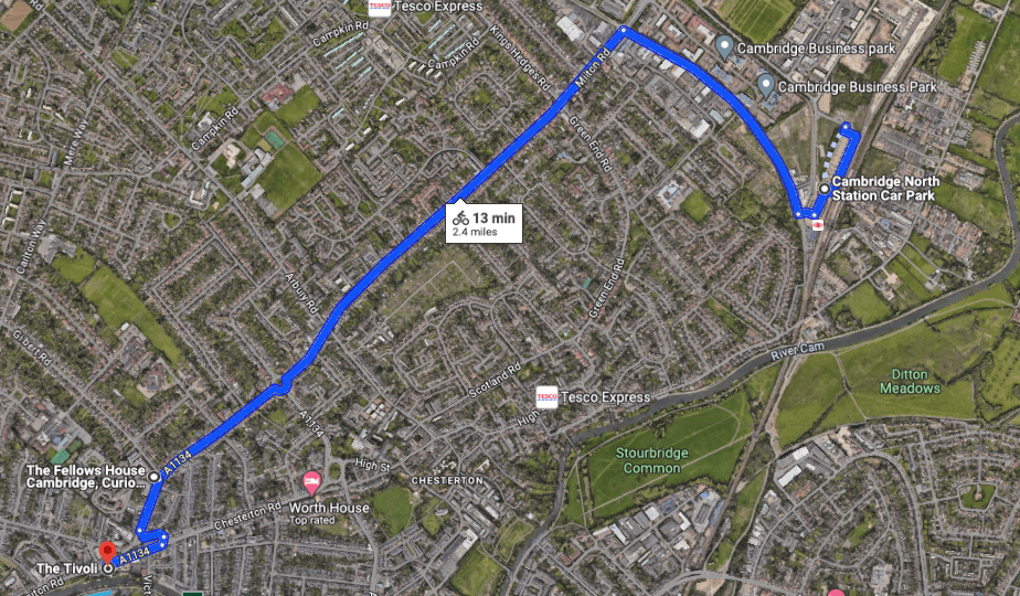
Some of you will have seen the news of the proposed ApartHotel at the old Staples site on Mitcham’s Corner. It’s not small. 164 rooms. (Could these be taxed given the huge number of Aparthotels going up?)
Above –
“And the interchange?”
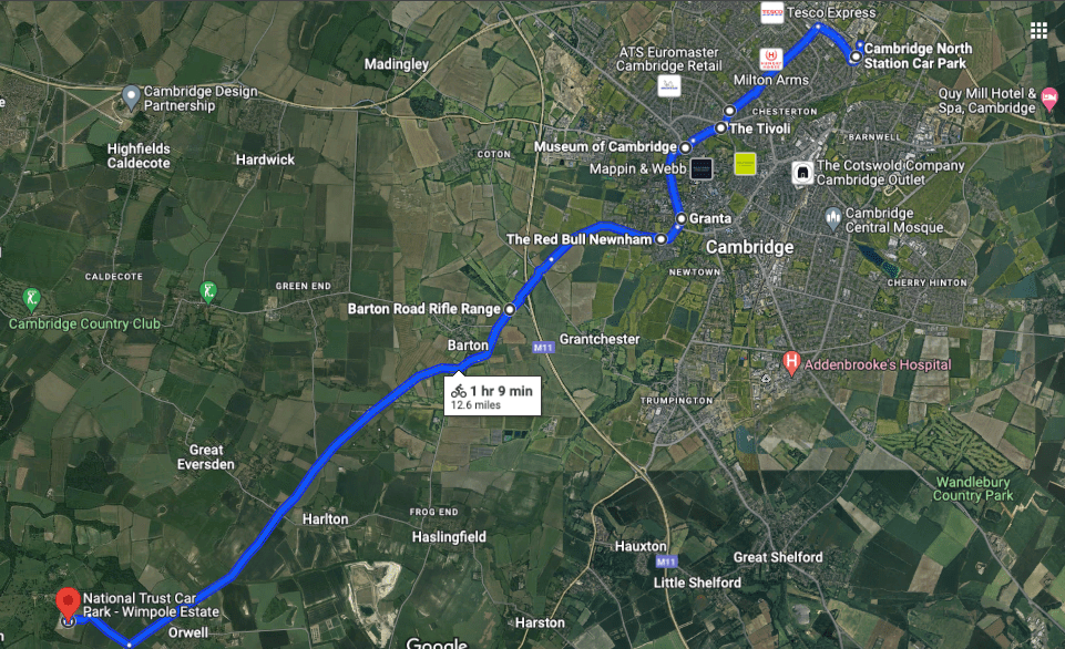
An East-West route could go from Bottisham to Eddington with the interchange at Mitcham’s Corner
Above – Bottisham to Eddington/Darwin Green – a ten mile overground tramroute?
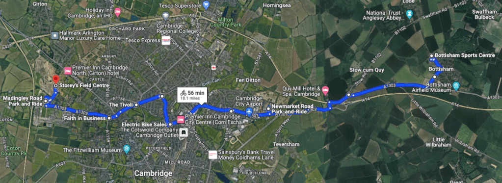
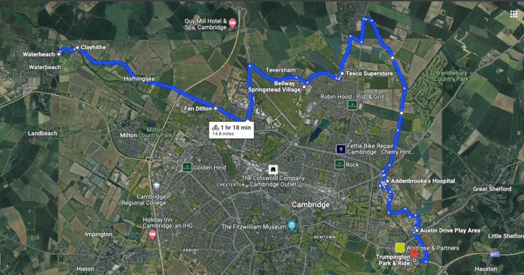
You could have a north-south interchange from Waterbeach Newtown Station to Wandlebury Country Park (or onto the Babraham campus) noting the image below has been rotated so North is on the far left, and South is on the right.
Above – rotated Waterbeach-2-Wandlebury with an interchange at Mitcham’s Corner
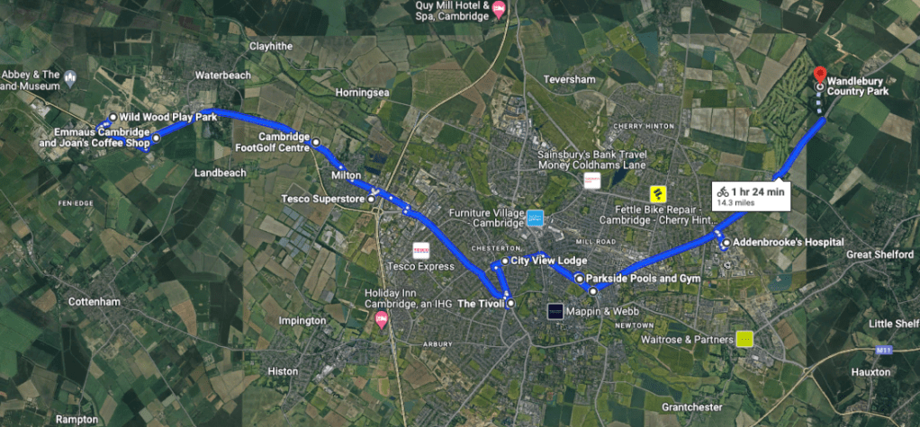
It goes via Parker’s Piece (next to where I want a new large concert hall) and and Addenbrookes, so could stop at Cambridge South en route to Wandlebury & Babraham.
When all routes don’t need to go through the city centre – an eastern tram bypass
The traditional mindset of transport planning is A-to-B commuting. The problem is outside of the Home-to-work-to-home-again lifestyle, it doesn’t meet the wider needs of society. Furthermore, this route from Waterbeach via Teversham to Trumpington tries to meet the needs of communities in the very new and proposed developments including North Cherry Hinton, Marleigh, Clay Farm (all under construction) as well as Waterbeach New Town and the Airport site which are part of the emerging local plan 2031-40.
Above – also rotated with North on the far left, Waterbeach Newtown via Marleigh, the Airport, North Cherry Hinton, and onto Addenbrooke’s.
The point with this line is that those new developments will need significant arts, sports and leisure infrastructure as well as their own employment sites – in particular the largest ones. Marleigh already has the Cambridge Ice Arena. In reality such a tramway would run through the airport site and could easily be diverted north of Fen Ditton along the A14 to serve the Hartree site where the sewage works currently is.
Alternatively it could form a tram-train service on an upgraded Cambridge-Newmarket line to serve the Capital Park and Mission Street sci-tech developments before heading along the existing airport runway towards Marleigh and the Ice Rink. That would also create an ideal place for a new large civic facility if the planners & politicians chose to have a transport hub for rail, trams, and buses where the railway line crosses Barnwell Road and Coldham’s Lane.

Above – the site for a potential new transport hub – where the CU Royal Naval Unit is.
With the proposals for the airport redevelopment already underway (I wrote about them here), imagine the airport site – rebranded Cambridge East here with up to 14,000 homes on it. Or alternatively, imagine the whole of Haverhill in Suffolk moved to that patch. That’s the level of civic and social infrastructure you’re looking at. Hence why we are at the stage where such big sites within Cambridge’s 1935-era boundaries have to have:
- A regional level civic/leisure facility that we do not currently have in a 30 mile or so radius
- Permanent public transport infrastructure that cannot be easily dismantled by a future government or by a climate catastrophe. (Okay, I’m wishing on the second one!)
The reason being that this isn’t a standalone development. Nor is Waterbeach Newtown. They are effectively urban extensions. This is also why Cambourne and Northstowe amongst other places need to be seen not just in the context of standalone developments, but also as places will want to visit and with good reasons. Given that most newtowns can’t start from scratch with heritage, a major arts/sports/leisure facility that has high quality permanent public transport links to/from surrounding towns and villages are essential.
Because as I wrote a few years ago, not everything needs to be in Cambridge. Ministers and lobbyists need to understand that we’d quite like to share these things out with surrounding settlements and have splendid public transport links to them – not just for us in Cambridge, but for everyone around the city who also is part of our city.
Food for thought?
If you are interested in the longer term future of Cambridge, and on what happens at the local democracy meetings where decisions are made, feel free to:
- Follow me on Twitter
- Like my Facebook page
- Consider a small donation to help fund my continued research and reporting on local democracy in and around Cambridge.
Below – what the old strategic/regional plan said in 2010. Progress update?

