Or rather, how do the documents contained within read today? Mindful that the original application was submitted to the city council way back in 2006
You can still find them today – go to https://applications.greatercambridgeplanning.org/online-applications/ and type in the reference 06/0796/OUT and all sorts of interesting things come out!
Scroll to the earliest listing which is on the second page of the items returned from the search – the application validated in October 2006 and you’ll find an item described as “Land To The West And South West Of Addenbrookes Campus Robinson Way Cambridge Cambridgeshire”
There are only 383 documents contained within that planning application so it’ll only take you between now and eternity to read through and understand them all! (I jest)
In the Masterplan document
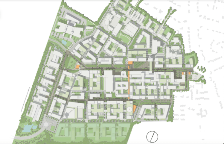
Above – the Cambridge Biomedical Campus outline map from p6 of the 2010 Masterplan
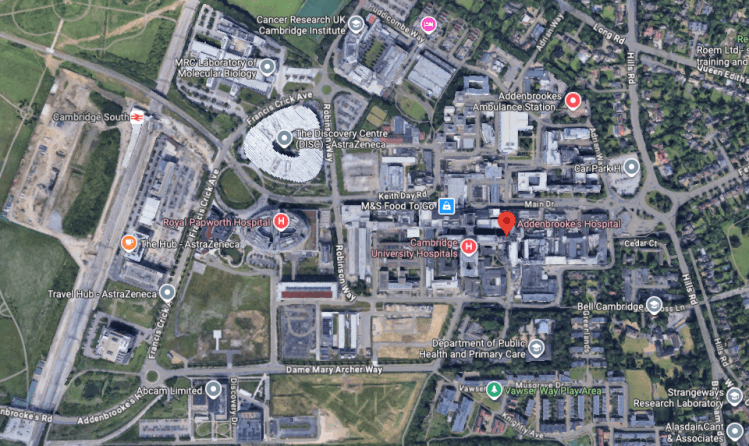
Above – from G-Maps 2026. Thus explaining visually the difference between a very high level Masterplan that approves the principle of development, and ‘reserved matters’ that emerge from that outline approval which deal with applications for individual buildings amongst other things
Hence Royal Papworth Hospital and the AstraZeneca buildings look nothing like the bland boxes on the 2010 map. But then if local residents were never taught the essentials of town planning at school, and have no opportunity to learn about it in their communities eg through a lifelong learning college, why would they know the difference?
Hence also why I’m using the term “Future of Cambridge” for all things I write about the emerging local plan and the Cambridge Growth Company proposals
“What happened to the private hospital plans?”
Good question.
I vaguely remember some controversy around the proposal, and it appears in an appendix to the Environmental Statement from 2006
Above – Appendix 1B Technical Statement of the Environmental Report (2006) p10.
Fast forward ***an entire decade*** and the proposals for the private hospital fell through – as Adam Care wrote in the Cambridge News in October 2016
“What did the proposals involve?”
“Plans for The Forum consisted of a combination of education centre, private hospital and hotel providing a venue in which clinical staff, researchers and academic staff can come together. The three elements shared common areas and benefited from common services, for example catering, waste management and FM services.”
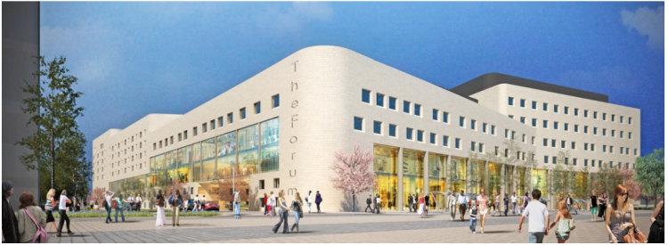
Above – from Northmores – last updated in 2020
“The Forum is a £120m infrastructure project, which will bring together a post-graduate medical education centre, a 75-bed private hospital, a 200-room hotel and a 550-seat conference centre. The innovative combination of these functions offers access to a social hub for CBC to encourage interaction between academics and CUH staff; will bolster Cambridge’s reputation as a venue for biomedical conferences, training and specialist healthcare; and will generate income for NHS services at CUH.”
From consultants PRD working for John Laing
“So…what has happened to the site?”
It’s now going to be where the proposed Cambridge Cancer Research Hospital (CCRH) is being built
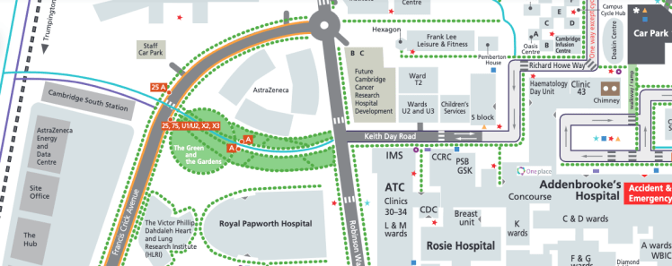
Above – the CCRH (top centre in beige) on the Cambridge Biomedical Campus map
Huge growth on Cambridge’s southern fringe
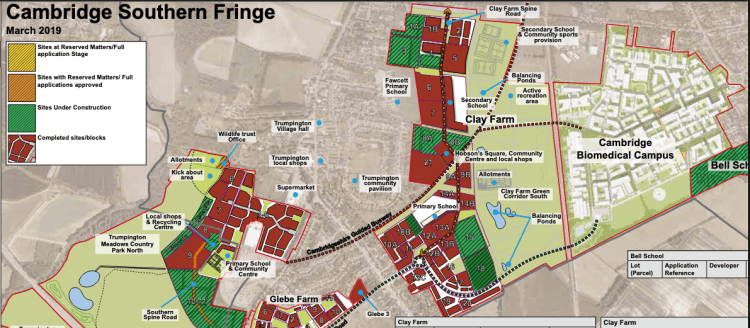
Above – Southern Fringe summary by Cambridge City Council from April 2019
It’s sort of surreal when compared with what will be the next phase of the growth of Cambridge – the map below from late 2025 shows many of the developments that were happening in 2019 as being part of the city’s urban footprint.
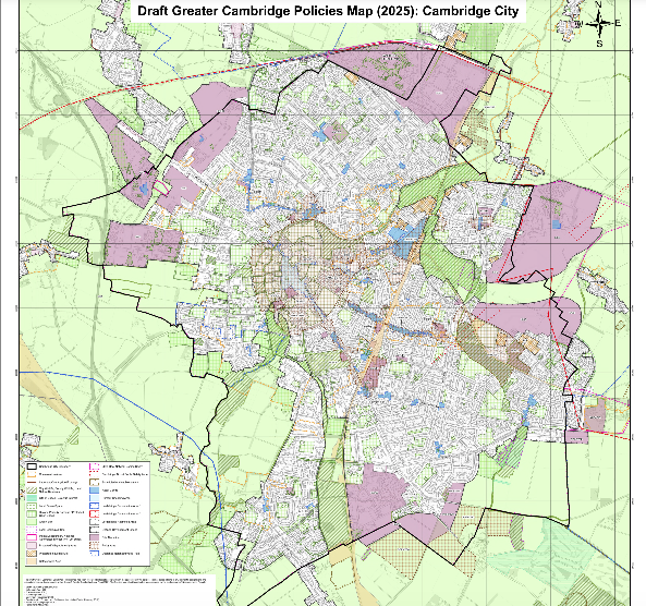
Above – the proposals for Cambridge (2024-45). You should be able to access the big map online here – failing that do a ‘Control+F’ for ‘Policies Map’ in the documents’ library list here
For local schools and further education colleges looking for projects for their children and students to do, there’s a wealth of material tucked away in various online archives and repositories that they could make use of. It doesn’t have to be content-heavy. A simple high-level project for older primary school children might look at how big proposals change over time, and the things that affect the decisions that people make. For example this blogpost covered:
- How the outline map for the Cambridge Biomedical Campus had boxy buildings on it, but the final buildings for boy Royal Papworth and the AstraZeneca building were curved
- The proposed private hospital was abandoned after the firm financing it with £120million of funding pulled out – the land being re-purposed for the Cambridge Cancer Research Hospital
- How the plans on the Cambridge Southern Fringe map are now broadly complete and now part of the ‘normal map’ of the city
I hope that in the overhaul of local government in England, more local public services will be brought back under local control – such as schools as I wrote here. That way, local councils will be able to produce (or commission) learning materials accessible to all of our city’s children. Because we’ve done it before – as Cambridgeshire County Council showed us in 1976.
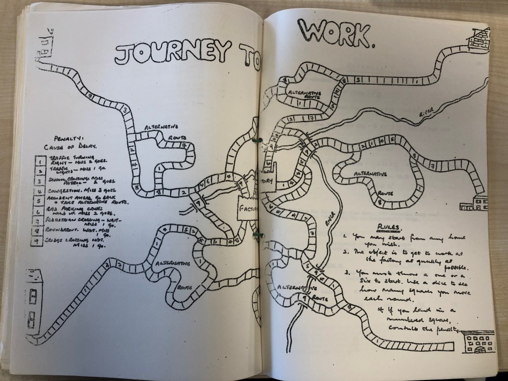
Above – from Aspects of Cambridge (1976) Cambridge Curriculum Development Centre in the Cambridgeshire Collection (C.36.1 PAM)
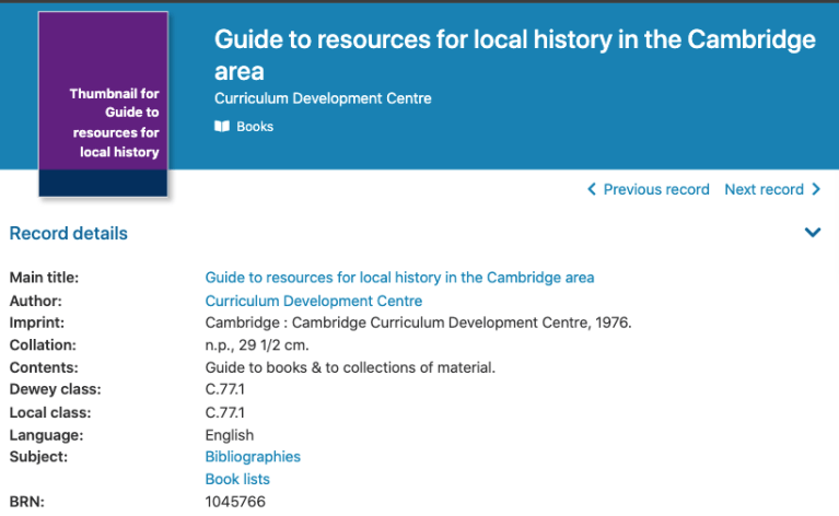
Above – from Cambridgeshire Library’s online catalogue which you can search here
The references above are from a blogpost I wrote about civic spirit in Cambridge.
Can we revive it even in these unstable and challenging times?
If you are interested in the longer term future of Cambridge, and on what happens at the local democracy meetings where decisions are made, feel free to:
- Follow me on BSky
- Spot me on LinkedIn
- Like my Facebook page
- Consider a small donation to help fund my continued research and reporting on local democracy in and around Cambridge.

