TL:DR – Quite a lot – and not least they can inform us of what questions to ask next time around. Which is now.
It seems like there’s a new consultation for something every other day in and around Cambridge at the moment. In part this is reflected by the fragmentation of local governance which successive governments have kept enfeebled for a variety of reasons.
Above – by Smarter Cambridge Transport. This is no way to run a city – any city.
Cambridge’s town plans past and present
The study that would be of most use to town, gown and village is an evaluation of the Cambridge Local Plan Annual Monitoring Reports from 2005 all conveniently stored here. What was envisioned by the writers and those that contributed to the local plan processes, and how much of what was envisioned was actually built? What was the deficit in the number of social homes? What did and did not get built?
The three big studies of the 20th Century are prominent not least because they are known by the chaps that wrote them:
- Davidge in 1934,
- Holford and Wright in 1950
- Parry-Lewis in 1975.
The Greater Cambridge Local Plan is striking in that no one – councillor, official or consultant, has been willing or able to put their names on the front of the report. Sign of the times on accountability where such reports are put together by seemingly anonymous committees rubber stamped by hard-pressed legislatures and assemblies who otherwise know little of the detail? Perhaps, to the untrained and unfamiliar eye. Having filmed and sat through more local plan meetings than I care to count (you can see the videos here – for which I was kindly commissioned by the Federation of Cambridge Residents’ Associations to do so). I saw for myself the essential role that FECRA members and volunteers of other community and voluntary groups played in scrutinising the lobbying by powerful and wealthy interests who could afford to commission expensive barristers to represent their views.
William Davidge 1934
I had a look at Davidge’s plan of 1934 – one that was very heavily influenced by the Cambridge Preservation Society – today Cambridge Past, Present & Future. You can watch the videos here. Someday soon I’ll get round to digitising the entire document. It’s full of incredible maps and lovely woodcut prints.
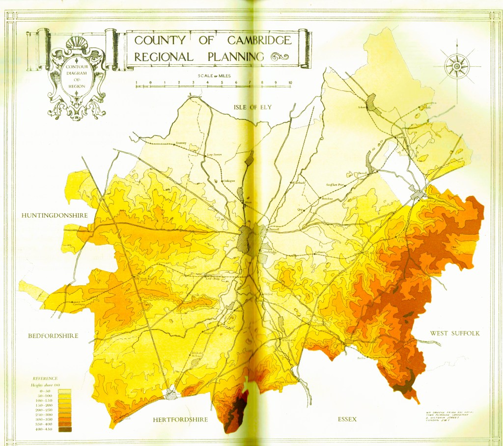
Above – the topography of Cambridge borough and county as was. What I really like about this map is you get a very clear sense of the height of the land, which also explains why Cambridge’s air quality is and has been notoriously poor for centuries; the town sits almost within a complete bowl, surrounded by slightly higher land. This means you don’t get the wind to take the stale air away unless it is very windy across the rest of the region.
Sir William Holford and Myles Wright 1950
I’ve dropped a detail from the incredible map that forms part of the report.
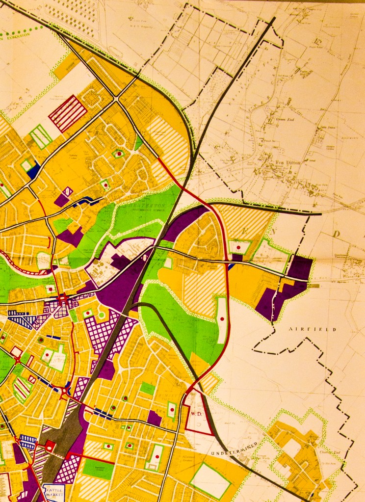
Detail from the Cambridge Development Plan 1950 by Holford and Wright. Cambridge City Council digitised part 1 of the report here. I wrote more about it in 2016 in this blogpost for Lost Cambridge. Finally, in 1956 Derek Senior wrote a lovely guide (which I digitised here) aimed at the general reader rather than the town planner as the political debate refused to die down.
John Parry Lewis 1975
The work of John Parry Lewis was ultimately too radical for both city and county councils. I can only describe his proposals to double the size of Cambridge in such a short space of time as audacious.
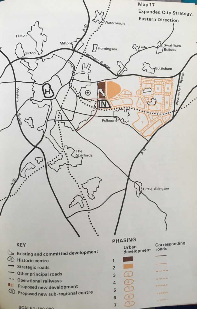
Above – Parry Lewis’s proposal for an eastward expansion of Cambridge. He also had one for a southward expansion. Both were rejected by councillors.
What the other council said
Coming back to Holford and Wright in 1950, it’s always the most inconspicuous-looking documents that have the gems and treasures hidden within.
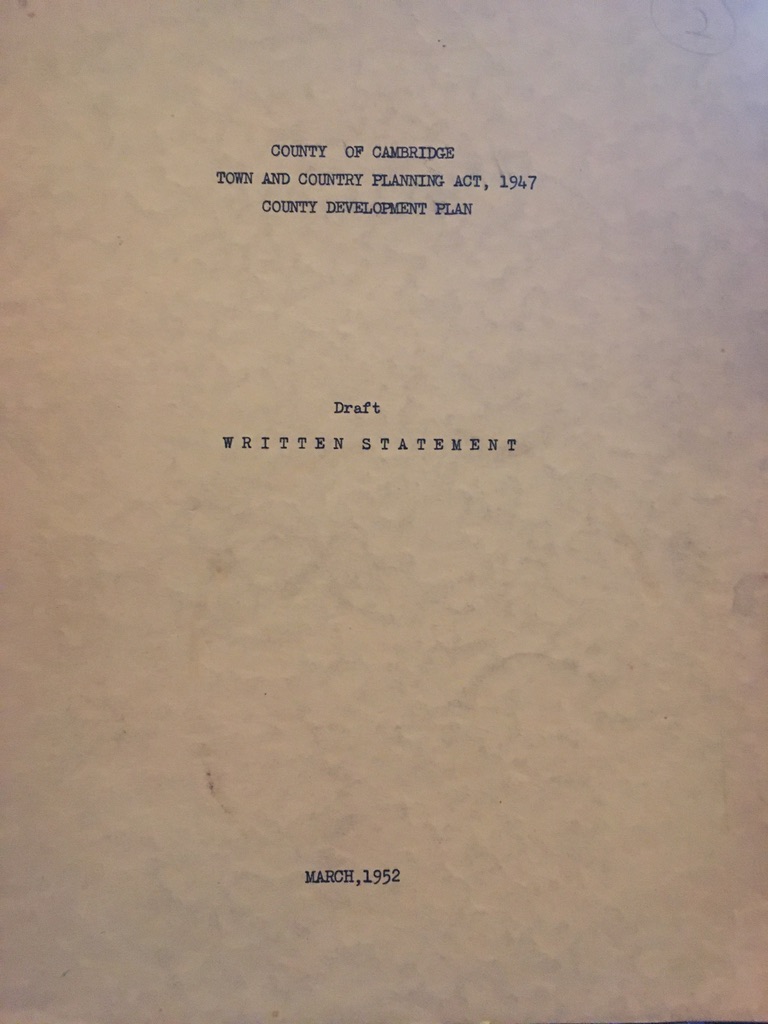
I found this in G.David Booksellers, open for the first time since the lockdown from the Covid19 Pandemic. It’s one of those things where you have to know some key phrases to be aware of its significance. In this one the “County of Cambridge” refers to the geographical area that today is Cambridge and South Cambridgeshire – but until the reform of local government in the 1960s formed what was known as “Cambridge County Council” for many years. The combination first with the Isle of Ely & Fenland, then with Huntingdonshire & Peterborough (the latter then separated in the 1990s) created what we know today as Cambridgeshire County Council. Yet confusingly for me, official documents us the phrases Cambridge County, and Cambridgeshire County interchangeably.
So…what was proposed by the County?
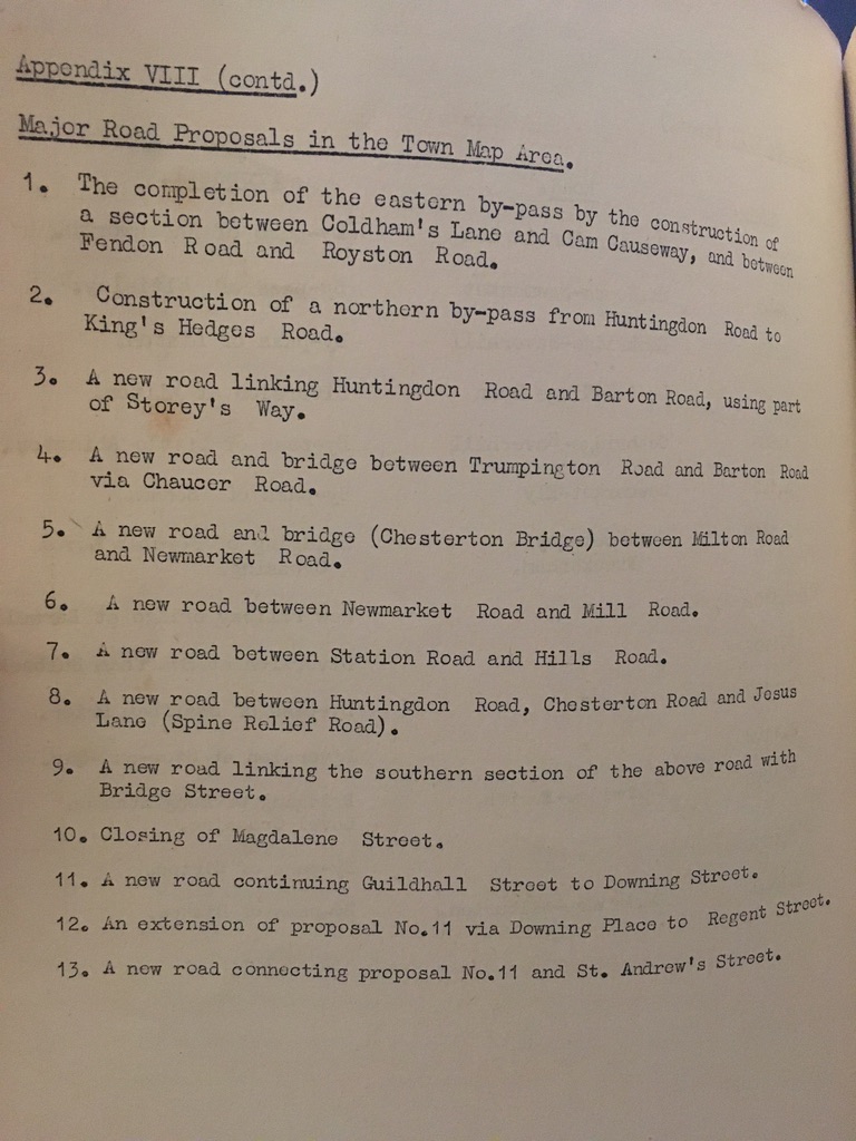
We got some, we didn’t get others.
But the question for local historians for each one is why? Why didn’t we get the big Eastern bypass linking Milton Road, Barnwell Road, Perne Road and Addenbrooke’s? (And compare that to why we are getting the Chisholm Trail that links North Cambridge with Cambridge Railway Station and Addenbrooke’s in 2020).
And finally….but perhaps most importantly, the community infrastructure
It’s ever so easily missed, but ever so important:
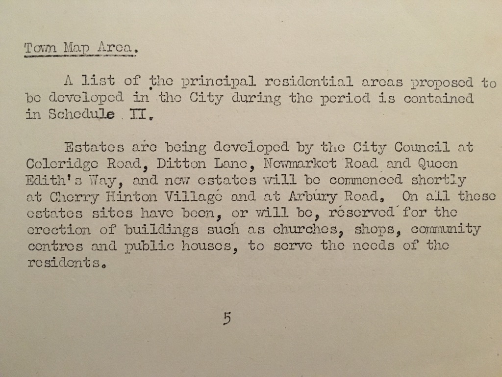
“On all those estates, sites…will be reserved for the erection of buildings [and then gives examples]….to serve the needs of the residents.” It’s a statement of intent.

Open spaces – in this case extending the area of open space along the River Cam in Cambridge that is available to the public. Again, statements of intent.
Statements of intent for the good of the city.
