As some of our council houses become too expensive to upgrade, but also too expensive for people paying fuel bills, the city council is looking at comprehensive redevelopment.
Some of you will have seen the report by Gemma Gardner in the Cambridge Independent here. The meeting of Cambridge City Council’s Housing Scrutiny Committee on 21st June 2022 will debate these – the meeting papers are here.
The proposed redevelopment of Fanshawe Road – off Coleridge Road
This is the bit I’m interested in – the light grey patch at the top of the diagram below is Coleridge Rec, with the play area, splash pad and paddling pool further north.

Many of the homes around here were built in the latter part of the interwar era, or in the years after the end of the Second World War. At that time, there were severe shortages of labour and materials. Furthermore the homelessness problem in Cambridge was as such that the need to get people into even half-decent homes was a priority – as it was for the rest of the continent ravaged by war. The council’s report states:
“Fanshawe Road sits in the Coleridge Ward in the southeast of Cambridge. The site is currently residential use consisting of 33 dwellings in the form of three small flat blocks of 3 storey, 2 adjacent houses and 39 garages.”
Item 10, proposed redevelopment of Fanshawe Rd, para 1.2. CamCitCo Housing Scrutiny Cttee 21 June 2022
“So, what’s the proposal?”
Currently in its very early stages, the plan is to get rid of most of the garages and have a large open space visible to the park/recreation ground and vice-versa.

The plan is to increase the density of housing – essentially 44 properties as council housing and 49 as either intermediate/80% market rent, or (if funds are not available) sold to the private market.
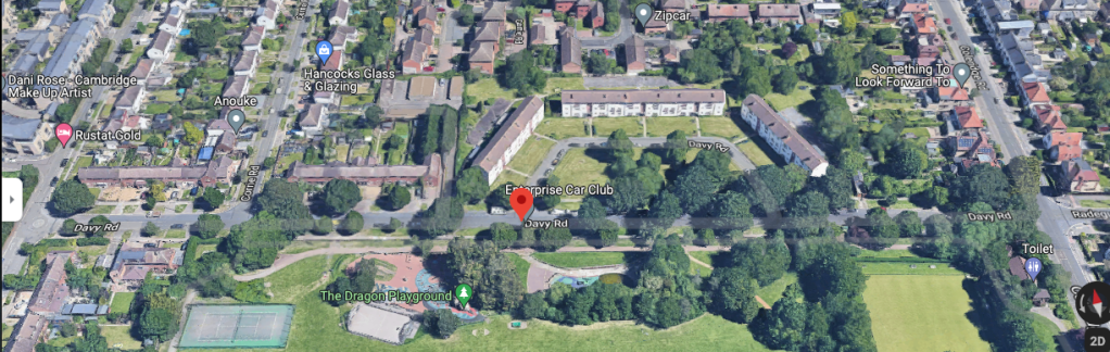
There is an identical set of council houses on the northern side of Coleridge Rec off Davy Road, that will need a similar overhaul if they are in the same condition as the ones on Fanshawe Road.
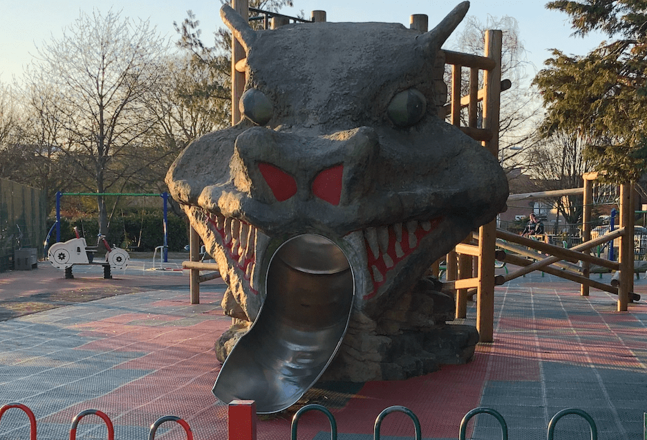
Below, you can see Fanshawe Road in the foreground from GMaps here, with Davy Road in the background just behind “The Dragon Playground” the dragon being the big dragon slide that got installed a year after Puffles the Dragon Fairy stood for election in Coleridge Ward in 2014.

Above – from GMaps here. You can see the similarities between the two developments. Note the bowling green in the top-right, and the pavilion with it, home to Coleridge Bowling Club.
Cambridge Railway Station’s long-awaited eastern entrance
This one’s been rumbling on for over a century. This is the Holford-Wright version from 1950, so nearly three-quarters of a century old, and we’re still nowhere near getting it.
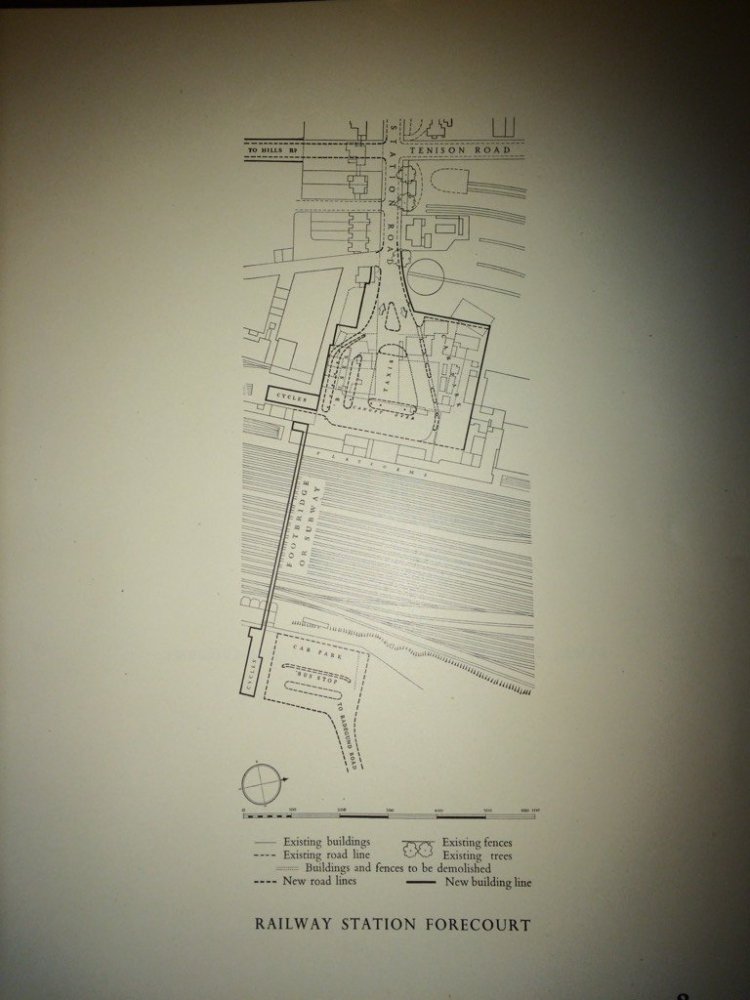
Above – from p8 of Vol2 of the Cambridge Development Plan 1950 by Holford & Wright, which I’ve digitised here.
This is the bit that we’re interested in – the bit that leads onto Davy Road and then Radegund Road.
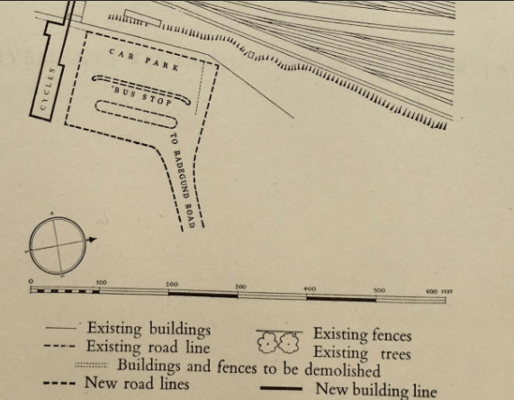
Above – Cambridge Station’s proposed eastern entrance, detail.
One of the reasons why this is going to come up again is because of East West Rail. Although ministers are making a complete hash of it, these projects take so long that by the time any firm decisions are made, we could have a new and more competent government in place – but I wouldn’t put the house on it.

Above – From EastWestRail, who are proposing more platforms at Cambridge.
I’m assuming it will be completed – and as a result the existing railway station will need additional platforms. The recently installed platforms were to cope with existing pressures. They were not designed to cope with East West Rail. The only place those platforms can go is to the east.
If we flip the map around, and re-orientate it with N–>
…we can see Cambridge railway station at the top (in the west), and Coleridge Rec centre towards the bottom (in the east). Mill Road is the main road on the right (in the north) with the yellow food icons, and Cherry Hinton Road on the left (going top-to-bottom, also with two icons) gives you the wider context.

Above – the wider context. You can also see the quadrilateral shape of the Davy Road flats by the red balloon icon.
There will be some interesting property negotiations to get the eastern entrance designed and built. Cambridge Station is at the top, Rustat Road and Davy Road are at the bottom centre of the diagram below. The Cambridge Carter Bridge is what I’ve always called “The Cycle Bridge” because when it was built, it was designed to take cyclists away from the death trap of the Hills Road – Cherry Hinton Road junction, and was the only cycle bridge of note in the city. Others have since been built.
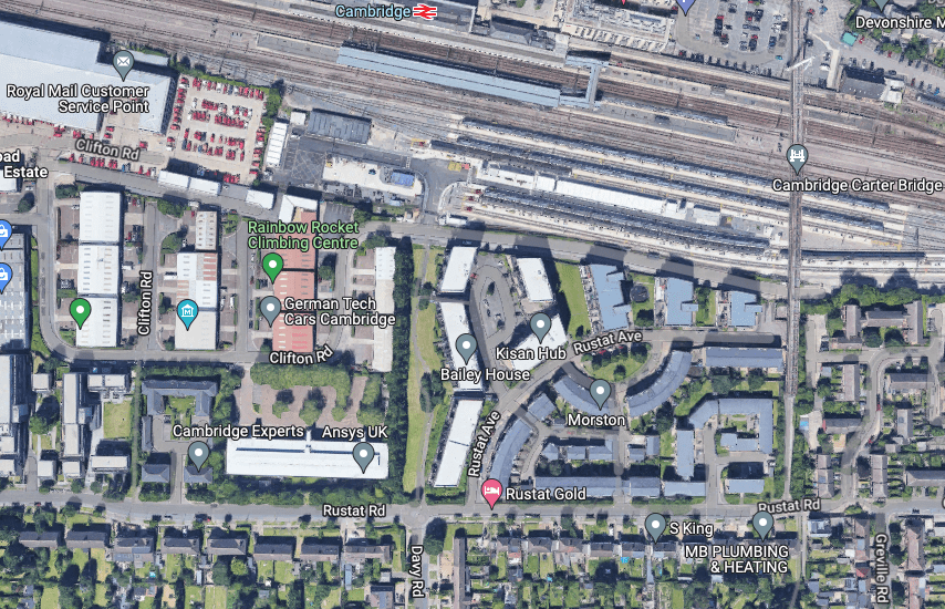
Above – from GMaps here, I can foresee property acquisitions clearing some of the warehouses of the firms on the Clifton Road estate to create a turning circle for buses, and a large cycle park for commuters.
The problem then becomes buses and the children’s playground in close proximity. Never a good mix.
The buses as per Holford & Wright’s plan of 1950 would have involved the former heading straight down Davy Road all the way down. How do we reduce the risk?
Above – Detail of Davy Road from GMaps here.
One option is that as and when East West Rail come to build their additional platforms, they budget for an eastern entrance with additional contributions from whoever is willing and able (for example city and county councils, combined authority) and S106/CIL funds from developers), is to carry out a similar redevelopment of the Davy Road flats and re-routing the buses along a re-routed Davy Road along where the flats are currently, and ‘stop up’ the part of Davy Road between the ends of the flats, creating a new space not just for new flats but also for a small community centre that can spill out onto the recreation ground. Thus creating decent toilets and changing rooms for people young and old, as well as a cafe.
There’s one thing that has to be managed very, very carefully. And one that cannot be left as a footnote (as it might look like here).
And that is the sequencing – with the existing residents at the heart of it. That means ensuring residents can be safely and with their active consent temporarily relocated locally while the building works are carried out, and are then re-homed into the new accommodation that has been built to a much higher standard, and with the new facilities.
It is this task that for me is both the most important (because it involves people’s homes) and the most difficult because it is the one that people in charge of large organisations with big budgets (especially those with no electoral accountability) are most likely to overlook.
But it can be done, and the net result in say 15 years time could be a significantly improved neighbourhood with more, better council flats, a new community centre, new public transport services, a new station entrance with lots of cycle parking which both shortens journeys to the railway station and reduces overcrowding on the other side.
Alternatively the climate emergency could have really kicked in and messed things up because people in power didn’t respond to the repeated warnings.
But I like to be positive.
Because this is my home ward.
For those of you who are willing and able to support my reporting and local historical research in and around Cambridge, please consider a small donation to help me continue my work. See https://ko-fi.com/antonycarpen. Thank you.