I’m trying to work out how I found the spreadsheet and information because the instructions from the Greater Cambridge Shared Planning Service keep changing, meaning half of my weblinks become obsolete far too quickly!
I’d like to think most local communities are already aware of what has been proposed for near them, but you never know. For example I completely missed the proposed Quy Tech – Land to the north of the A14, Stow cum Quay proposals
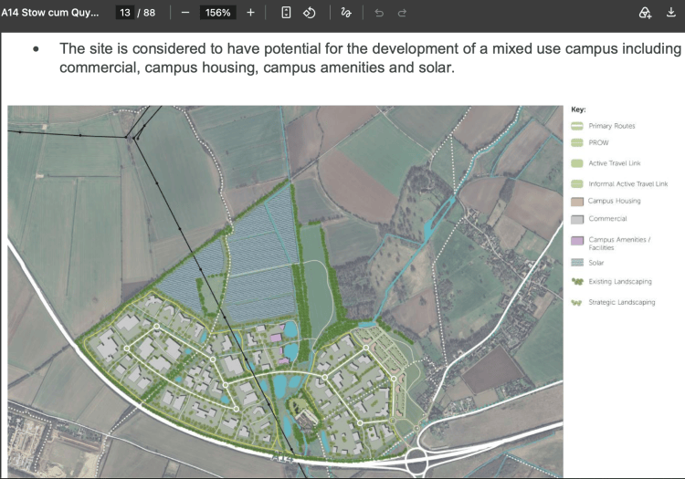
Above – Proposal for Quy Tech (NOT INCLUDED IN THE DRAFT LOCAL PLAN) from the submission here, p13
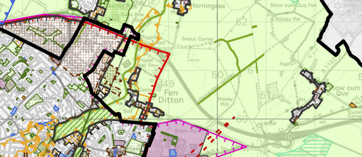
Above – detail from Greater Cambridge Draft Local Plan shared policies map (second document in the list here), showing the Green Belt around both Fen Ditton and Stow cum Quy staying in place
“How do I search the spreadsheet?”
The link to it is at the bottom of the first call for sites page here
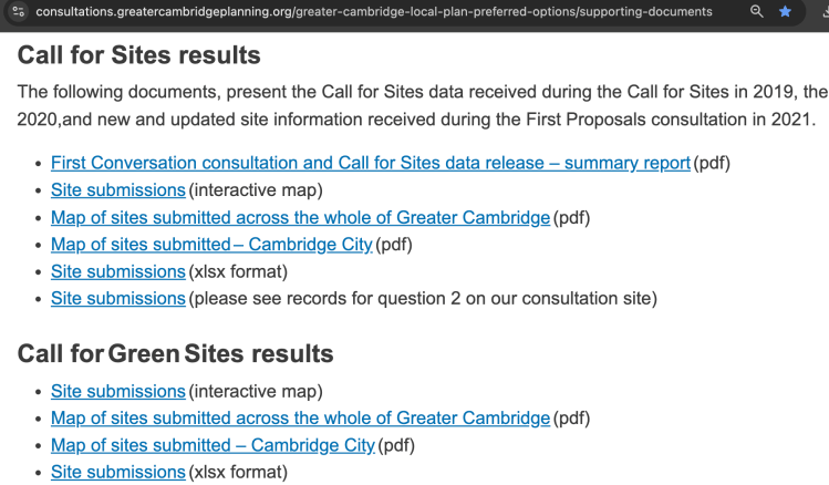
Above – screengrab (not interactive) showing what to look for. The link is the ‘Site submissions (xlsx format)’ link. If you cannot see it, you’ve not scrolled down far enough!
The spreadsheet looks something like this below – although I’ve sorted the data by area size.
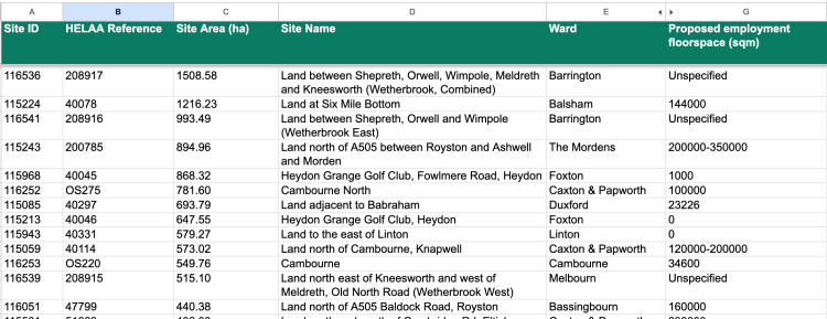
The reference to look for is the HELAA Reference
You then copy the URL https://oc2.greatercambridgeplanning.org/form/XXXXX and replace the XXXXX with the numbers in the HELLA reference. (The ones beginning with OS don’t seem to come up. The one thing they appear to have in common is that they are existing sites being carried over – developers wanting their cake and to eat it, either unable or unwilling to build out those existing planning permissions fast enough).
“How do I find the ones in my area?”
Do a keyword search for the city or district ward you live in or are interested in (or toggle the drop-down filters option).
Looking at Cambridge’s growing southern fringe
Junction 11 of the M11 at Hauxton is here on G-Maps.
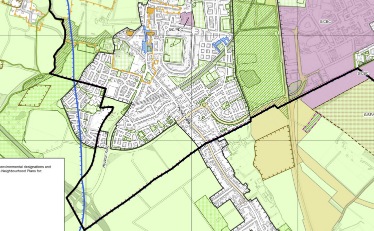
Above – detail from Cambridge City Inset Map of the Cambridge Southern Fringe at Trumpington, with J11 of the M11 next to the white text box showing the Green Belt protections intact. Note the allocation in light purple south of the bold black line – this is the grey hellscape I moaned about in this article when Prologis presented their proposals at the Cambridge Biomedical Campus open forum a week or so ago.
None of that stopped British Land putting forward proposals to extend Trumpington right up to the M11 with lots of boring boxes for visitors to shield their eyes from before getting to the dreaming spires and teeming towers of the old colleges.
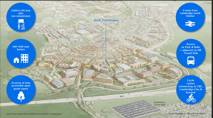
Above – British Land with Stantec and Allies and Morrison, update January 2026, p45 also NOT INCLUDED IN THE DRAFT LOCAL PLAN
Cambridge risks being surrounded by walls of boring boxy buildings
Anyone remember when Cambridge Past, Present and Future dubbed Brookgate’s proposals for land around Cambridge North Station ‘The Great Wall of North East Cambridge‘?
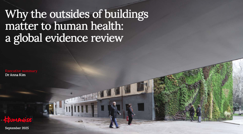
Above – Why the outsides of buildings matter to human health: a global evidence review
I added more to what was happening by Cambridge North Station as the depressingly dull reserved matters applications came through last June.
If developers carry on like this, the only way to get into Cambridge without having to pass the bland, boxy buildings is to enter the city from Barton Road through Newnham.
Unless the college landowners get their way with a repeatedly-refused application to build out on the south-western fringe of Cambridge.

You can read the documents from January 2026 here (NOT INCLUDED IN THE DRAFT LOCAL PLAN)
The group consists of The University of Cambridge and Corpus Christi, St John’s, Jesus and Downing Colleges.
“This reminds me of the anti-busway campaigners”
It should – one of their biggest concerns was that the busway was a means to open up the west of the city to development – and huge profits for the colleges at the expense of the Green Belt and environment. This also fed into whether such growth by the University of Cambridge and its colleges was sustainable.
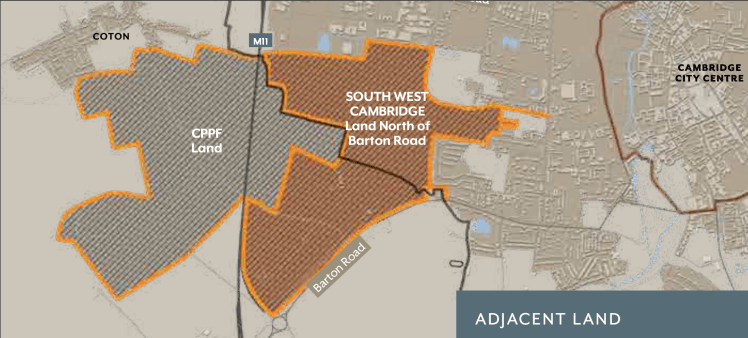
Above – DLP Vision Document (2026) p11 – you can see how the busway route goes through the Land North of Barton Road site, the orange ‘finger’ being the busway hitting Grange Road, after which as the Planning Inspectors concluded, the busway won’t contribute towards reduced congestion in Cambridge City Centre.
Note Cambridge Past, Present and Future’s land which almost a century ago town and gown united to buy strategic plots of land in the name of the Cambridge Preservation Society to stop ribbon development and urban sprawl.
When you look at the application area on G-Maps here, it’s another Eddington-scale development they are proposing.
It’s not a good idea to build on land that has a high flood risk
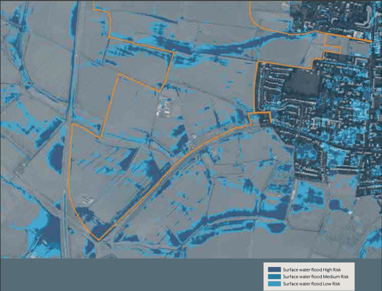
Above – DLP Vision Document (2026) p22 – which in normal terms should settle things. Given that context I’d have thought that in the face of increased frequencies of summers like the one we’ve just had, turning this area into a wetland and nature reserve would be a better solution, not least because if some of the areas of high flood risk were turned into lakes, it might have something of a cooling effect in the local area.
A sense of identity – created by identikit boxes?
Above – DLP Vision Document (2026) p66 – I’m not sure why they felt the need to mention a charter created nearly 18 years ago by Gordon Brown’s Government – the charter and the organisation responsible for it (Cambridgeshire Horizons) being abolished by the Coalition Government along with the East of England Plan and the structures of Regional Government shortly after.
But if you want to read the Cambridgeshire Quality Charter for Growth, you can read it here.

Above – Cambridgeshire Quality Charter for Growth (2010) Cambridgeshire Horizons, signed off by the Minister for the East of England
Bonus points if you can remember who the minister was, and what their remit was.
On a more serious note, the content is worth reviewing and refreshing by today’s decision-making institutions
“Despite a plethora of good design advice, many new developments are criticised for their quality. In part this is due to the use of unimaginative standard house types, and also to highway engineering, where concerns with safety and traffic movement have badly affected the look and feel of places.”
Above – CQC (2010) p12
Those design issues have not gone away. If anything, the climate emergency that is very much here and now is going to make those issues even more challenging.
“The idea for this charter grew out of work on the new town of Northstowe and the
need to ‘look and learn’ from other places”
Above – CQC (2010) p14
14 years after this document was published, developers and property professionals had made such a hash out of Northstowe that ministers in the new Labour Government decided to intervene and impose Homes England as the new master planner. As I’ve written before, ministers should commission a review of the shortcomings/what went wrong with both Cambourne and Northstowe – taking the view that the residents of both towns deserve far better. (That and having something to refer to in order to avoid making the same mistakes). There is a more devastating take from elsewhere in the Political matrix:
“Northstowe has inadvertently been burdened with all the disappointment of a country that has failed to plan for its future. But it will endure as a symbol, a visual reminder of our politics’s failure to execute any sort of aesthetic or functional vision for Britain.”
Above – “The limbo of England’s newest town” (2025) by F Sculthorp
As a written piece it’s damning on the decision-makers and property-professionals involved. But I don’t think the blame should be extended to residents who in the grand scheme of things are to blame, just as the residents of Arbury in 1960s Cambridge were not to blame for the lack of amenities in their new neighbourhoods.

Above – Cambridge News, 25 March 1965 in Lost Cambridge where I transcribed the full article.
As for the transport assessment by WSP, it feels like it was written by someone unfamiliar with bus services. Furthermore, it also feels incredibly out of date even though it was apparently written in late 2025 and approved in early 2026
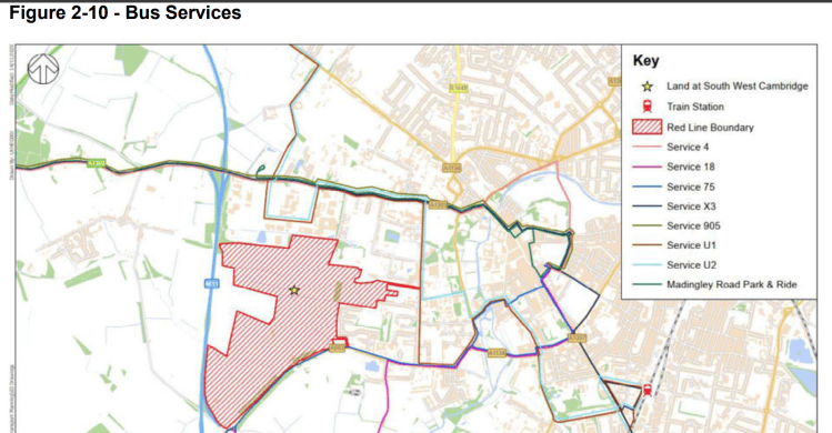
“The analysis above highlights that the Proposed Development benefits from strong existing public transport connections, both locally and regionally.”
Above – WSP (2026) p22
I might forward that one onto residents in Newnham and/or the Cambridge Area Bus Users Committee to see if the consultants’ words match their lived experience. Mindful also of the cautionary note the Leader of the Labour Group on Cambridgeshire County Council, and the former Chair of the Greater Cambridge Partnership Cllr Elisa Meschini (Lab – King’s Hedges) told the recent Labour Party Conference about from the podium.
“We (Cambs residents) are projected to lose 20% of our bus network by 2035”
Above – you can watch Cllr Meschini’s speech here
We live in turbulent times.
If you are interested in the longer term future of Cambridge, and on what happens at the local democracy meetings where decisions are made, feel free to:
- Follow me on BSky
- Spot me on LinkedIn
- Like my Facebook page
- Consider a small donation to help fund my continued research and reporting on local democracy in and around Cambridge


